the village
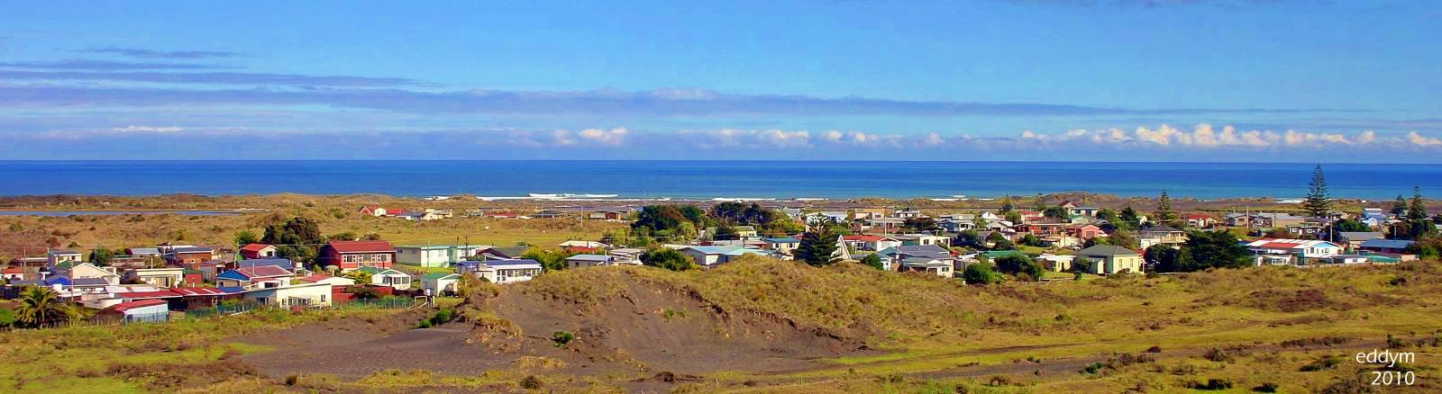
The village of Koitiata was established within the boundaries of the Koitiata Domain in 1917, as a “seaside resort” for the residents of Rangitikei. Over the last hundred-plus years, it has developed into one of those increasingly rare small seaside villages, where you can live in an uncorrupted and unspoiled part of New Zealand.
The population is a mix of people, all seeking to live out their rendering of a “getting away from it all at the beach” lifestyle. The village remains a small, nondescript place on the coast, with about half of the village’s 117 houses lived in by one hundred or so permanent residents. The balance of the properties are holiday homes, for people from all over the lower half of the North Island, and some even further afield.
Koitiata’s location has determined that the community needs to have a working connection with the local natural environment. They have been constantly active in creating and maintaining tracks and pathways, which enable villagers and visitors to have easy access to the beach and other open spaces. The community also drives local environmental protection and habitat renewal efforts in the recreation reserve, wetlands, and other parts of the village’s surroundings.
Koitiata is an increasingly popular destination, with the camp ground becoming a haven for weekend and holiday visitors, coming for the quiet natural setting. The Te Araroa Trail runs through the village’s surroundings, with some walkers on the trail often using the village as an overnight stop. The children’s playground and other facilities adjacent to the campground and the beach access track are well-used and appreciated by visitors.
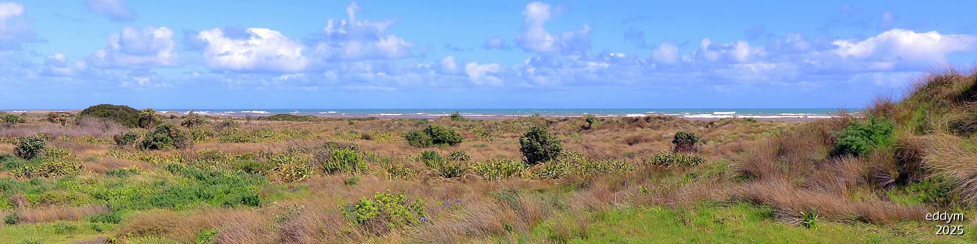
The ever-changing long black sandy Turakina Beach is the community’s playground. Whether fishing, white baiting, gathering firewood, walking, or just sitting and talking or gazing out to sea, the lives of the Koitiata residents revolve around the beach.
the beach
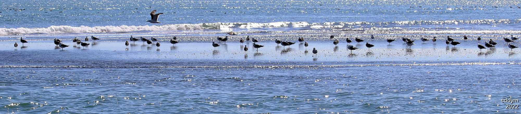
Turakina Beach is the basis for the establishment and continuing existence of Koitiata. The beach begins adjacent to the village, from the southern bank of the Turakina River’s most northern mouth position. It then extends south down the Rangitikei coast, towards the Rangitikei River, 28 km away.
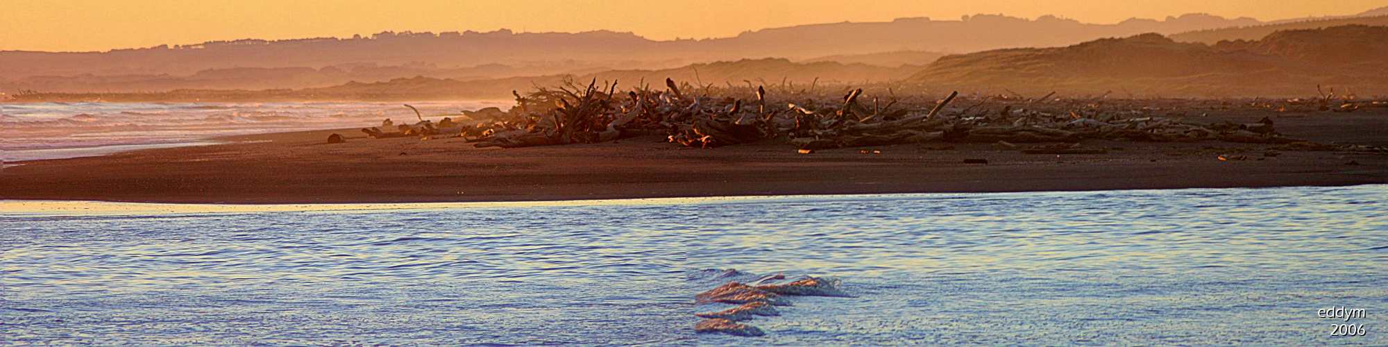
It is a typical west coast black iron sand beach and nature ensures that it is always a dynamic landscape. Strong onshore winds, high tides, crashing surf and the moving river mouth continuously relocate the sand of the beach and the dunes.
First time visitors are always fascinated by the vast quantities of driftwood that sometimes cover the beach. The driftwood, which can sometimes make passage down the beach difficult, is deposited by a combination of big seas and high rivers. It is buried by the moving sands and then uncovered again, sometimes years later, by the sea or by the relocation of the Turakina River and its mouth.
The changing location of the river, its mouth, and the dunes is both a fascination and a challenge for both Koitiata residents and visitors. A firm surface today can be a soft sand trap tomorrow. Whether travelling on the beach, searching for a suitable boat launch location, or seeking that bountiful fishing spot, the beach must be treated with respect. Waiting for the tide to go back out while the saltwater ruins your stuck vehicle’s upholstery and electrics gets you focused on what ‘respect-for-the-beach’ and its environment means.
the river
The Turakina River flows southwestward from its inland source, located south of Waiouru, and reaches the sea 140 km later, adjacent to Koitiata. While serving as a provider to the residents of Koitiata and visitors, the ever-changing mouth of the river can be disruptive and impact the beach and its adjacent environment.
When the river floods, it often means that Beach Road access between the village and the highway is cut, sometimes for days at a time. And when the flooding coincides with high tides, the encroachment of flood water into the playground/camp ground area of the village can be a result. Flooding of the village by the river has not been recorded.
Although flooding episodes are rare, the relocation of the river mouth up and down the beach is perpetual. The river mouth position ranges over 3.5 Kms of Turakina Beach, between 1.5 Kms north and 2.0 Kms south of the village. The beach is affected by these river course movements, and the resulting transformations frequently disrupt the physical characteristics of the beach and dunes.
When the mouth locates itself south of the village, its course usually dictates that the beach is on the seaward side of the river. While the river’s moods provide a constant challenge for Koitiata’s residents, through necessity, they have learned to cope with the disruptions to beach access caused by the river and mouth changes. It’s what living at the beach is all about.
the lagoon
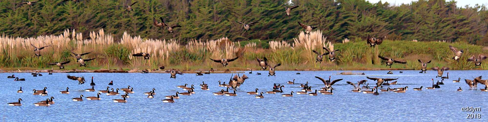
When the river broke through the beach and shifted its mouth to the north of the village in July 1998, the old riverbed area became closed off at each end, resulting in the formation of a 4 km long freshwater lagoon. High river levels had occasionally resulted in the lagoon briefly encroaching into the campground area, a situation that, history tells us, regularly occurred when the river was previously close alongside the village. Although the river has continued to shift its course up and down the beach, it remained on the seaward side of the lagoon and dunes.
Access to the beach and river, across the lagoon, was through a sometimes substantial depth of water. It was improved when a causeway, designed and built by the residents, was completed in 2002. Following the lagoon’s formation, a freshwater lake existed, containing water and aquatic life that attracted numerous species and volumes of bird life. Although the depth and area decreased over the summer months, there was always adequate water, and of a quality that made it an attractive haven for many types of waterbirds throughout the year.
But nothing stays the same. Wind-driven sand eventually filled in the causeway. Dunes that lined the seaward side have been washed away by the river, and wind-driven sand has moved into and filled the lagoon. Water content is now mainly replenished with rainfall, and run-off with varying degrees of contamination from adjacent rural land. Occasionally, the combination of a big sea and a high tide flows seawater across the beach into the lagoon area. But, whatever its source, it all usually drains quickly, leaving only a few murky puddles.
The actions of both nature and man have determined that currently, the lagoon’s water may only be a few cms deep for short periods. Some ponds remain, but now the lagoon is mainly a sticky mud flat during and after periods of rain, and dry and dusty at other times. It is most often now, only interspersed with a few muddy holes containing water of dubious quality. The consequence of all these changes is now a relatively sparse bird population throughout the year. Are the birds telling us something?
the reserve
The reserve is an approximately 60 Ha area of undeveloped natural land to the south and west of the village. Koitiata Domain was established in 1915, and Koitiata village was established within its boundaries. The village area was separated out from the reserve in the 1980s, and then in 2009, the name of the reserve was officially amended to Koitiata Domain Recreation Reserve. It is Crown Land but has suffered from being “a kind of no-man’s land”, with minimum management and, except for occasionally expressing “annoyance with the locals”, a reluctance by the authorities to take responsibility for its management.
This area of dunes and wetlands is mostly unmanaged wilderness, with a strip beside the village having been developed by residents to accommodate the children’s playground, the BBQ area, and an overflow space for the camp ground. Numerous tracks have been created, primarily to enable beach access when the river location creates a barrier. A recently upgraded walking circuit of 1.7 km was created in 2010. Residents also established, and manage, a green waste site to help prevent dumping into the reserve and in the dunes. Concern has often been voiced by residents about the spread of introduced noxious plants. A quote from a 2007 report, “…a group of conservation volunteers, with input from authorities, could halt the decline … but this may never happen”.
Well, it has happened. In 2020, the Koitiata Wetlands Restoration Project commenced. Koitiata residents, with resources and financial support from numerous authorities and organisations, joined to make a concerted effort to remove introduced plants and weeds. There has been over 3,000 volunteer hours put into the project, with great success. The expectation is that when the weed removal is achieved, nature will be quite capable of taking care of the rest. A Management Plan is to being developed to ensure that the project objectives, “to improve and preserve the ecology of the wetland so it protects and supports biodiversity, mainly birds and wetland plants, and provides an area for residents and visitors to explore and enjoy”, is achieved, and maintained, well into the future.