the Camp Ground
facilities
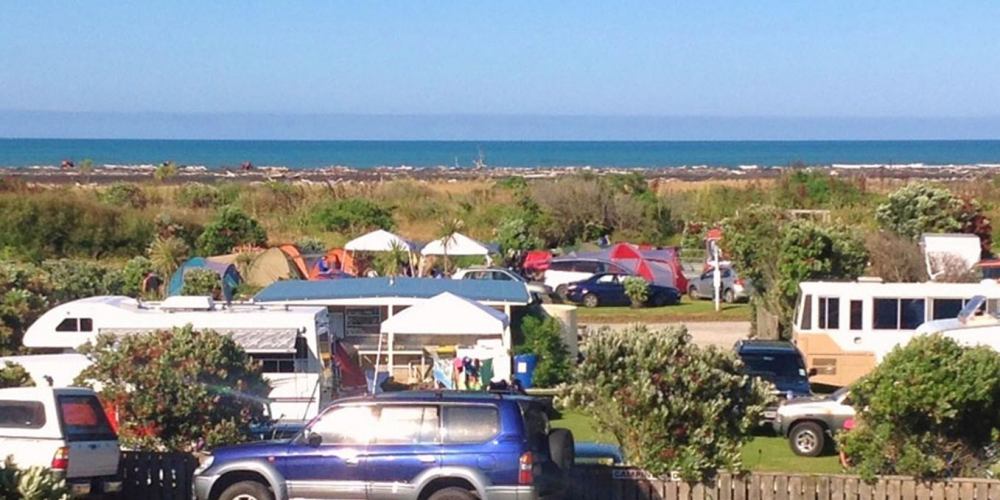
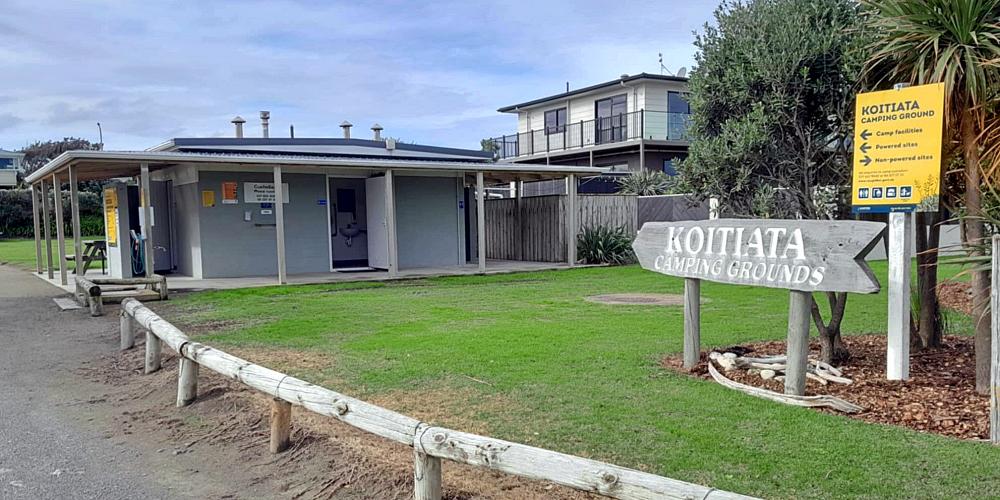
The Koitiata camp ground is located on the seaward side of the village, between Rapaki and Teone streets. Vehicle entrance is off Teone street, just south of the playground.
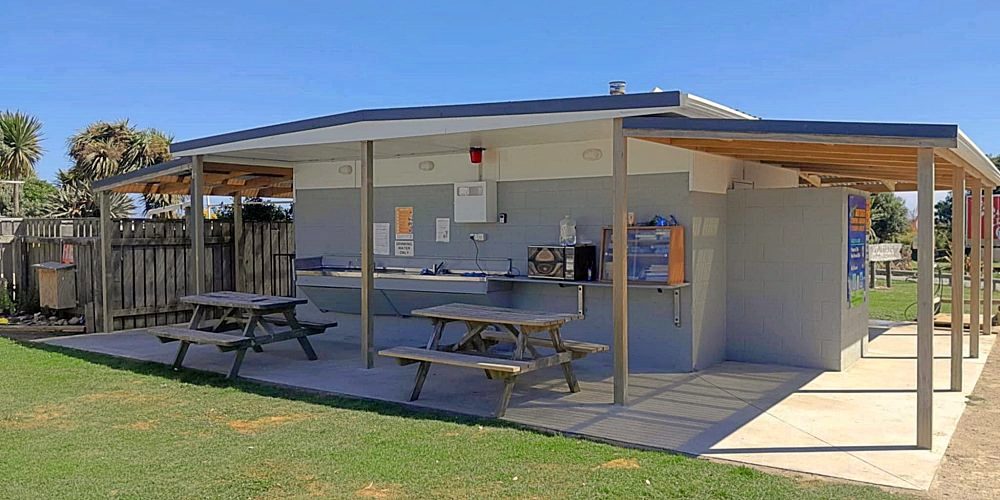
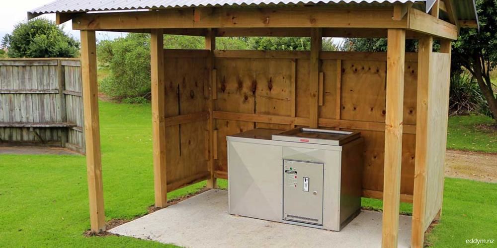
Powered and un-powered sites. Unisex flush toilets. Unisex showers, $2 coin operated. Dump station for camper vans.
Playground and BBQ across the road. Beach is across the river, a 300-metre walk via a sand track. The nearest shop is in Turakina, a 10-minute drive.
camp fees
Powered Site,
per night – $20
NZMCA – $16
Unpowered Site,
per night – $15
please note
Member of NZMCA Campsaver
No card facilities available, cash only.
If change is needed, please refer to the custodian.
for Visitors (and locals too)
childrens playground
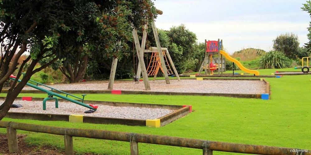
Located at the northern end of Teone street, is a well-equipped children’s playground.
Lookout Platform
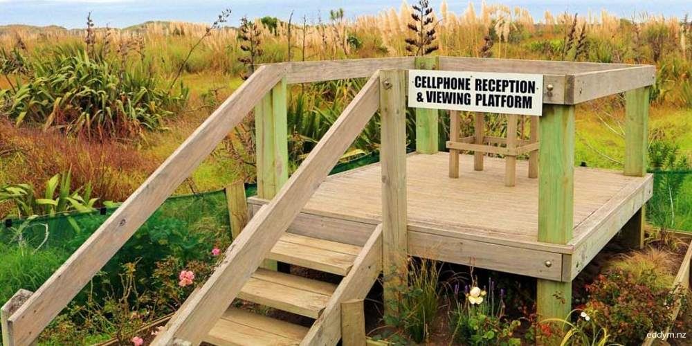
Opposite the camp ground entrance, the lookout enables views towards the sea, and can be used as a mobile phone reception location.
BBQ
A $2-coin operated BBQ is located next to the entrance to the beach access track.
Public Toilets
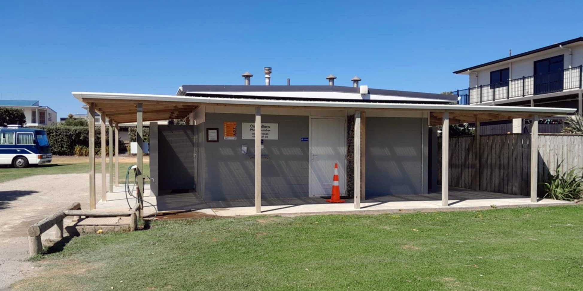
Public toilets are available at the camp ground.
getting to the beach
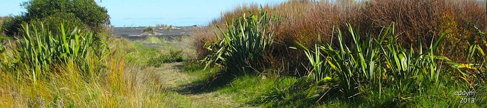
Track to Beach & river
The beach track begins between the playground and BBQ. During summer, the beach access is usually dry. At other times of the year after periods of rain there can be some wet areas where the track joins the beach, or river bank.
A walkway has been created beside the track, but the ‘vehicles giving way to pedestrians’ rule still applies. Moreover, please note that standard road traffic rules apply to the access track and all the beach areas. And be aware of tide times when travelling on the beach, they can block access up and down the beach.
There is parking for cars in Teone Street; park well clear of beach access tracks to avoid damage to your vehicle.
Beach Interpretation Board
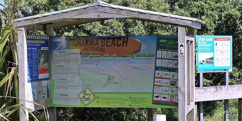
An information panel about the beach and its environment is in the shelter on the left of the beach access track entrance.
The panel was created by DOC and the Koitiata community. It was erected, together with the shelter, by community members in 2008.
While the sign was being created the river mouth, which is constantly moving, required that its location at that time (June 2008), be ‘date-stamped’ onto the sign.
As of August 2025, the river mouth has moved again and is now about 200 meters north of where it is shown on the panel. (refer to more river information below).
river mouth location
The degree of ease or difficulty for beach access is determined by the repeatedly changing course of the Turakina river and the location of its outlet to the sea.
The relocation of the mouth up and down the beach ranges over 3.5 Kms, between 1.5 Kms north and 2.0 Kms south of the village and the main beach access track.
Access to the beach may not be only affected by the river’s current position. It can also be disrupted by the alterations made by the river, to the physical characteristics of the beach and the dunes.
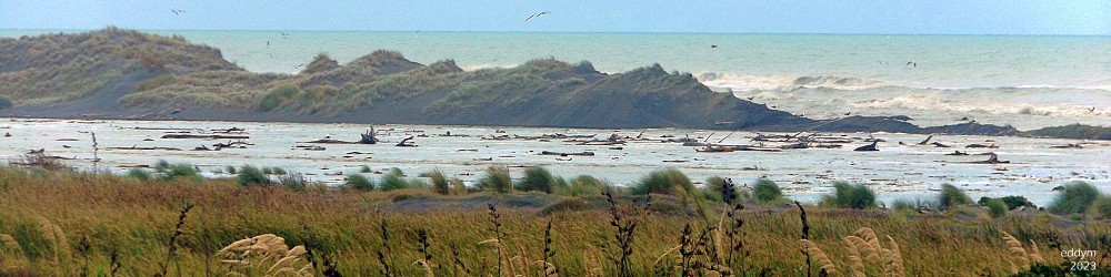
Above. February 2023. Water from river and sea flowing into the lagoon. Mouth is on the seaward side of the dunes, about 1.5 Kms south of village
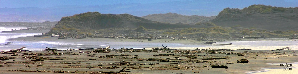
Above. August 2008. The river has broken through at its most northern location, 1.5Kms north of village
into the reserve
where it is
Unlike the ever-changing river, the Koitiata Domain Recreation Reserve is still located in the same place as when established in 1915.
It is all of that land located south and west of the village, between the forest and the old river course. For 1.6 Kms south of the village, it is all of that undeveloped landscape of dunes and wetlands, with its numerous man-made access tracks.
Being relatively unexploited, it still supports a natural habitat for mainly species of birds and wetland plants. And it also provides an area for residents and visitors to explore and enjoy.
what’s in the reserve
Besides the birds and plants, there is a 1.6 km walking circuit starting and ending on the southern edge of the village.
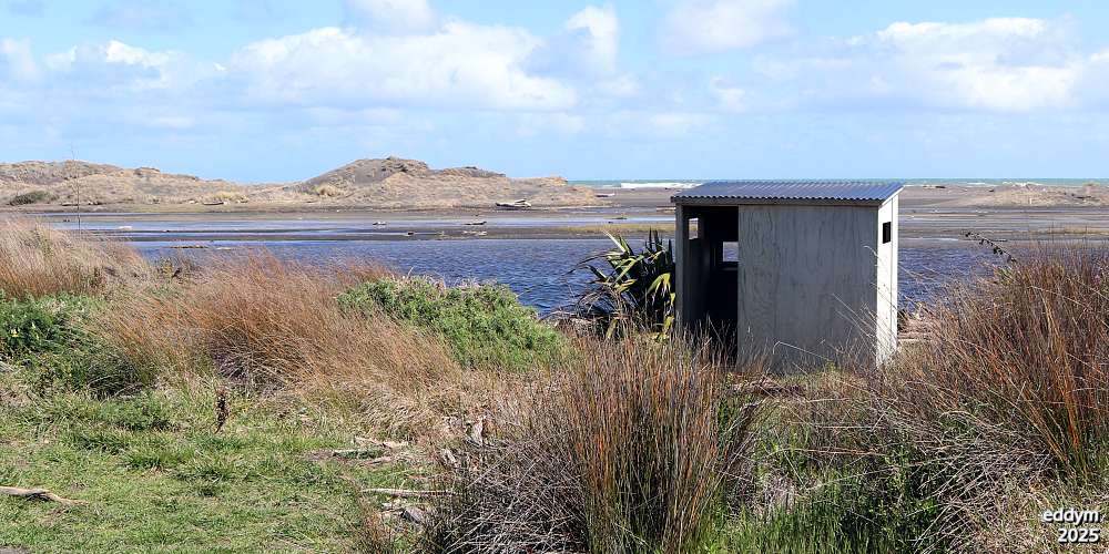
A bird viewing hut has been established in the reserve, at the edge of the lagoon, for use by visitors and residents
where things are in the reserve
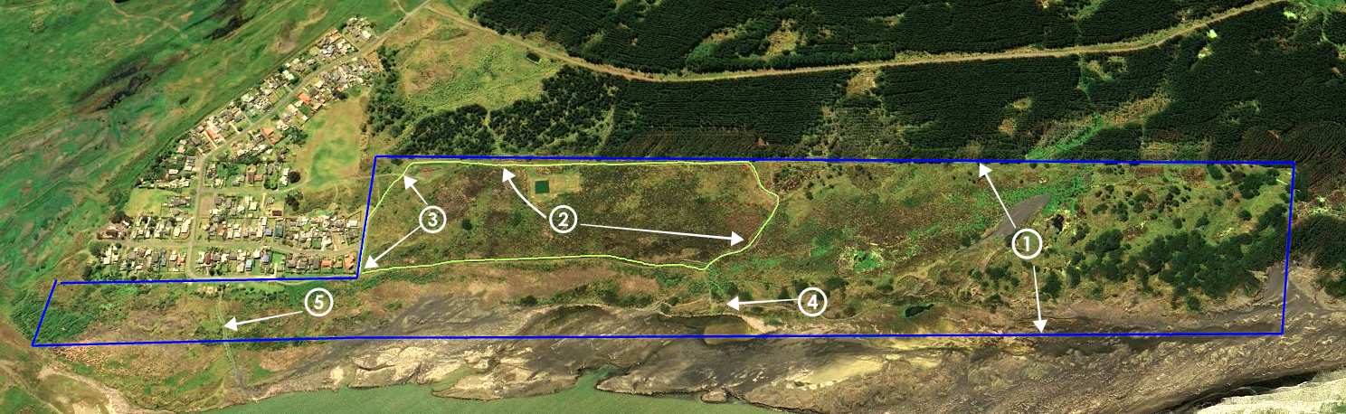
1. The boundaries of the reserve, area of 60Ha, 1.6Km from Rapaki street to southern edge, (indicative only).
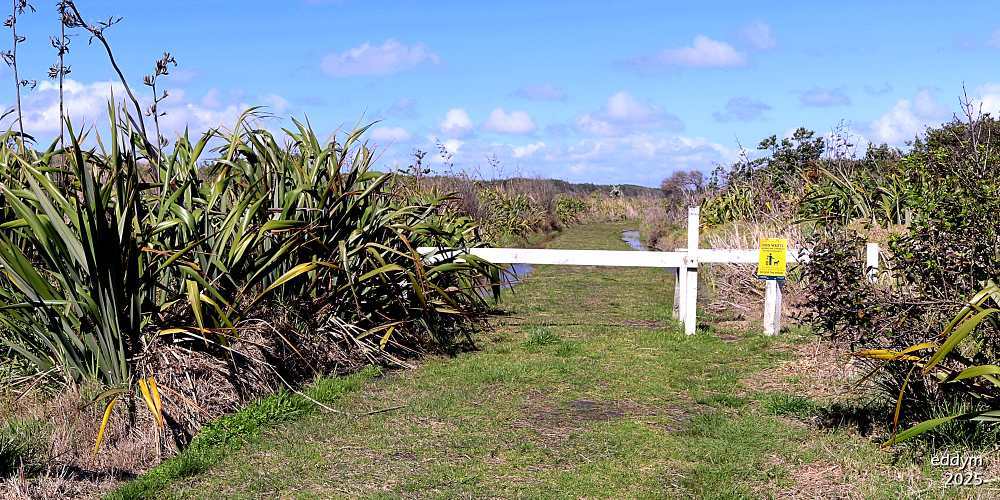
2. Outline of walking track, with a circuit of just over 1600 metres. Can have wet patches after rain and during winter.
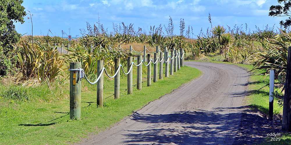
3. Entrance points for the walking track/circuit. Go through the white barrier at the corner of Rapaki & Teone streets, or start at the corner beside the green waste area.
4. Location of the bird hide. Access to hide is via the side track branching from the walking track, towards the lagoon and beach.
5. Main track to river and beach, which starts between the playground and BBQ.