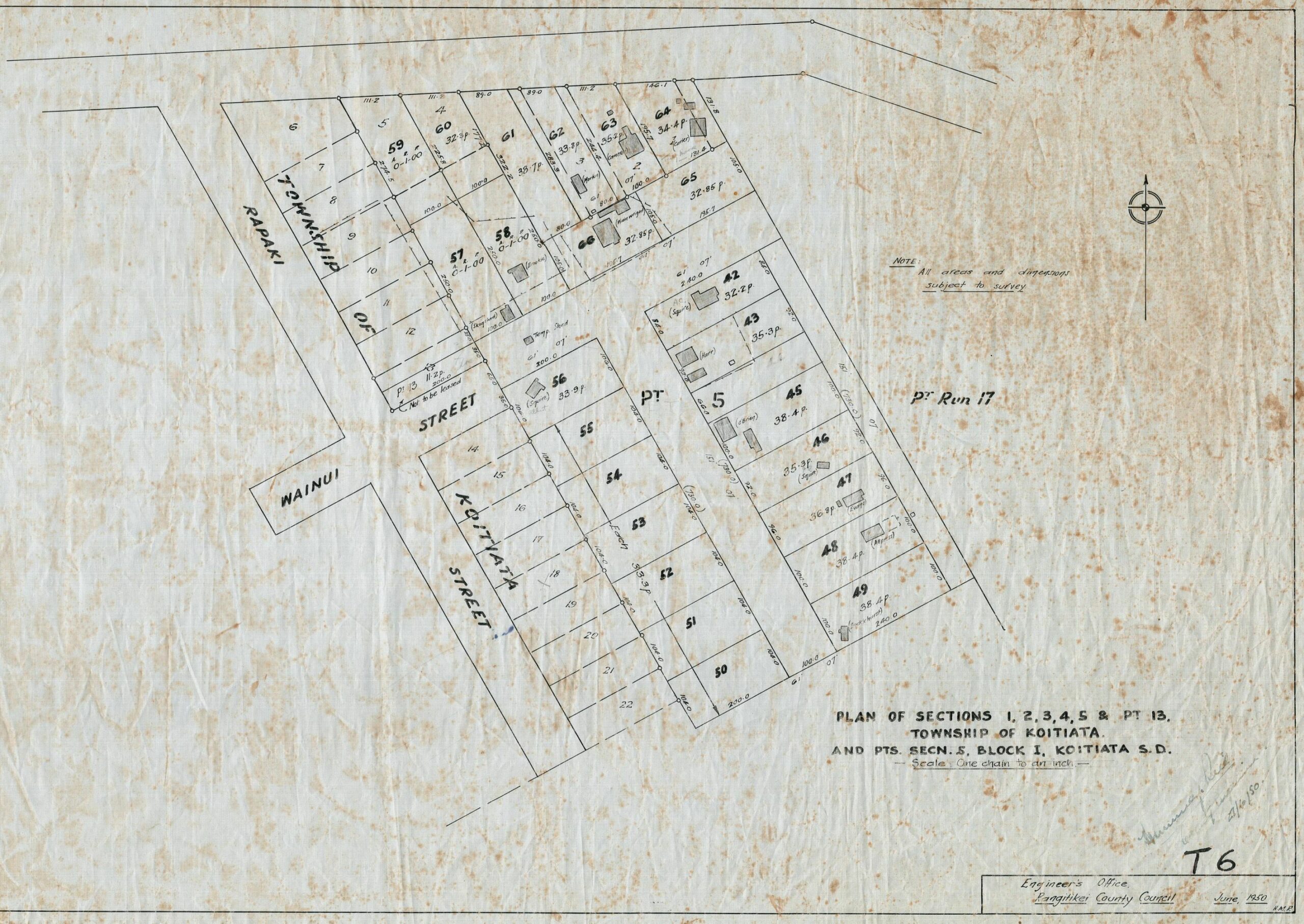
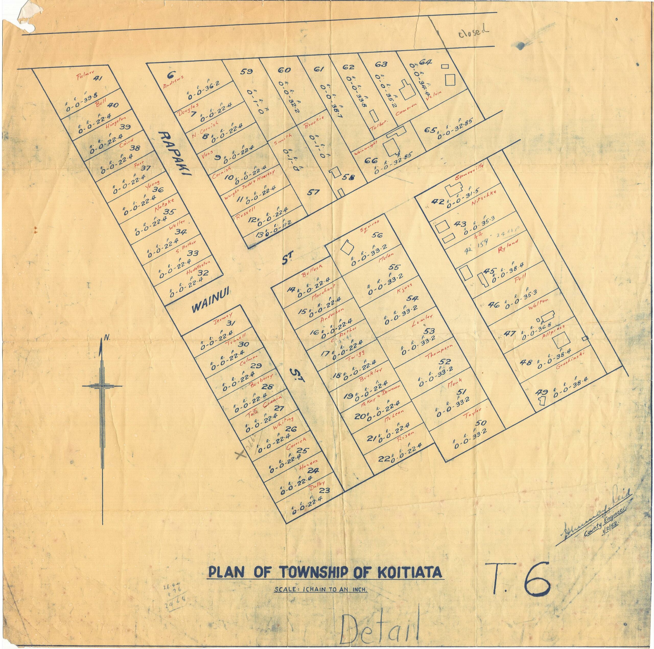
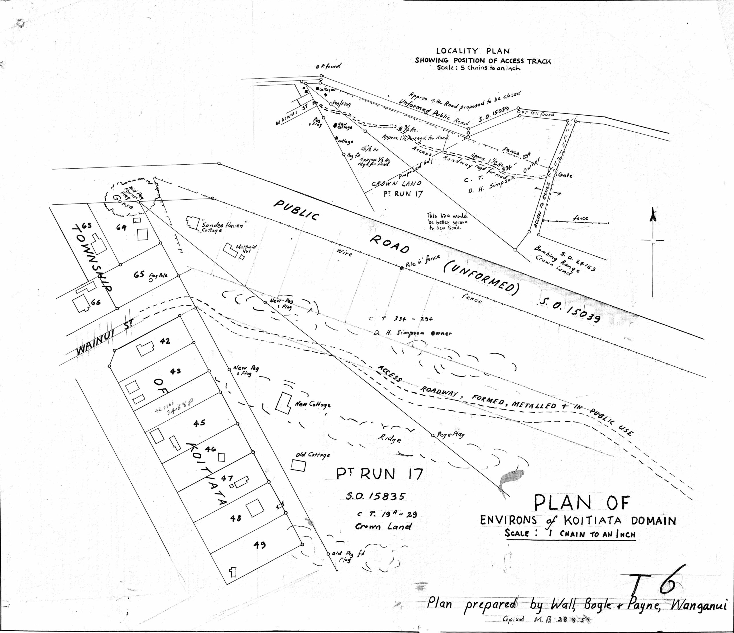
High Resolution Maps of Koitiata
The Map icons on this page provide access to higher-resolution versions of these nine maps. They have been selected from the Maps collection to enable interesting content to be viewed at a higher resolution than the collection copies provide. Each map will open individually in your browser window.
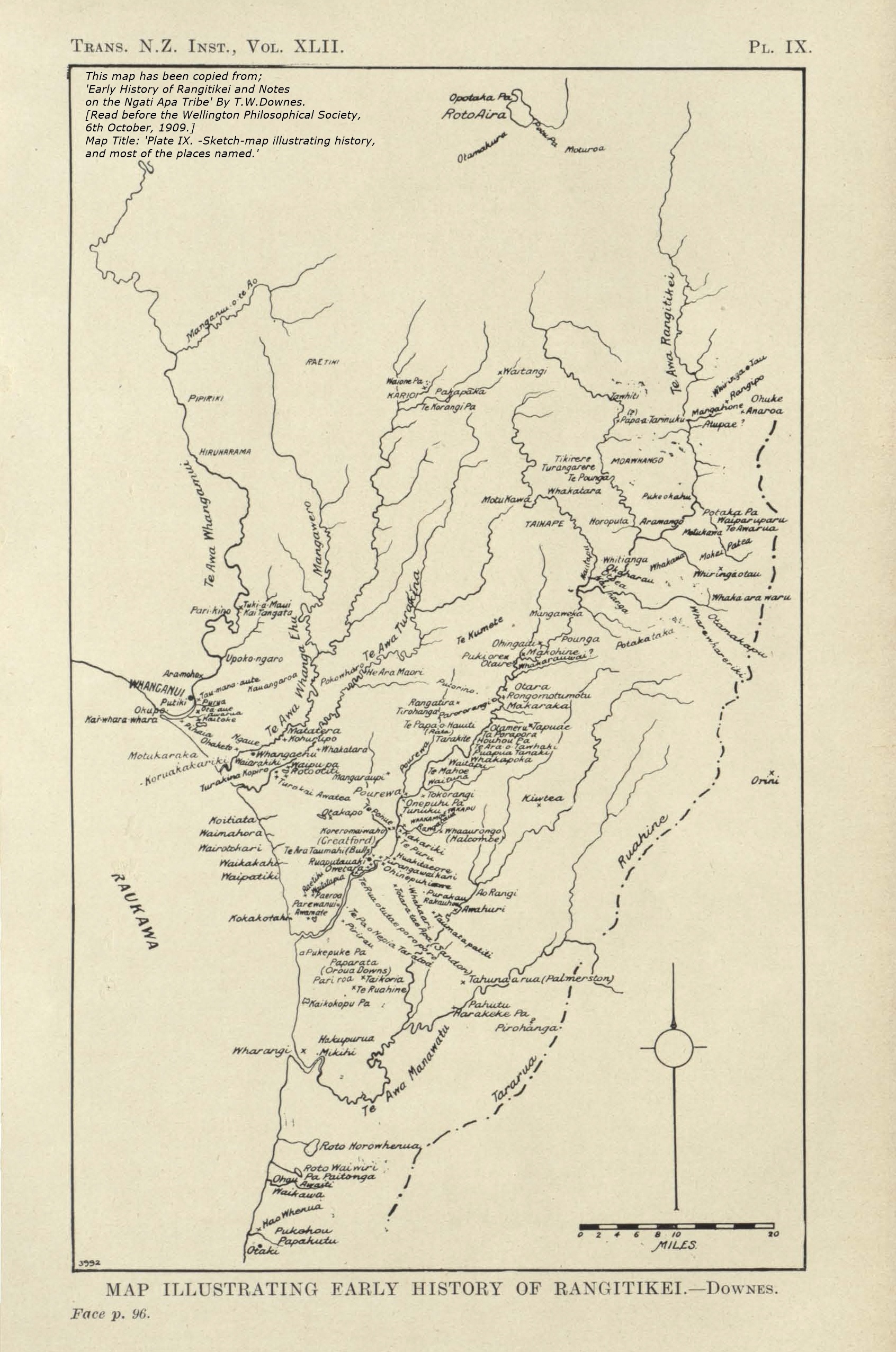
Early Rangitikei
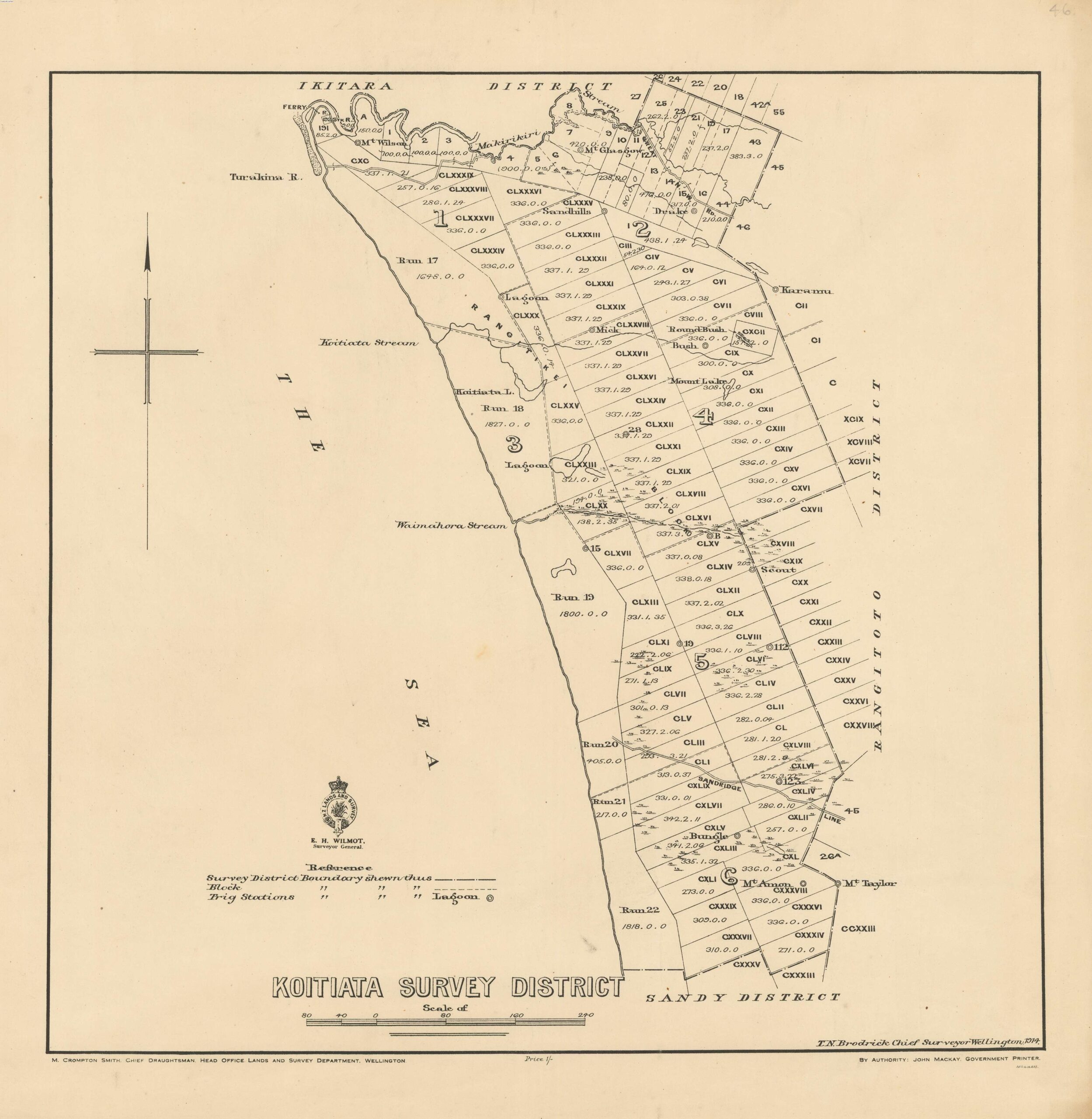
Koitiata Survey District
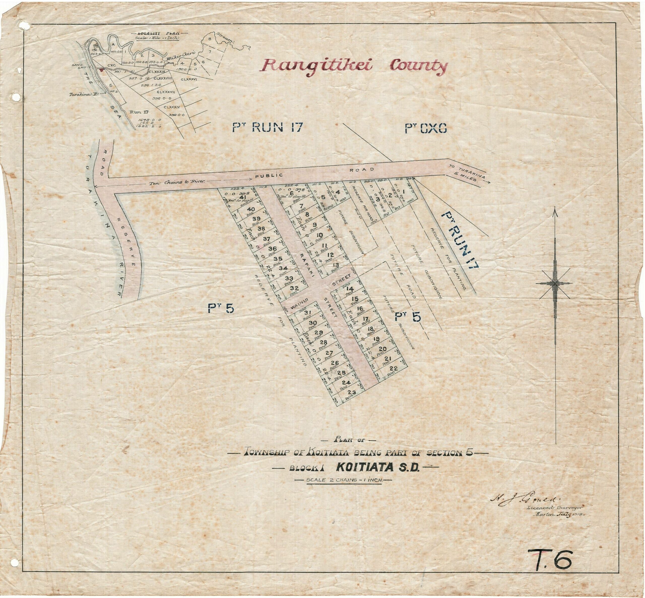
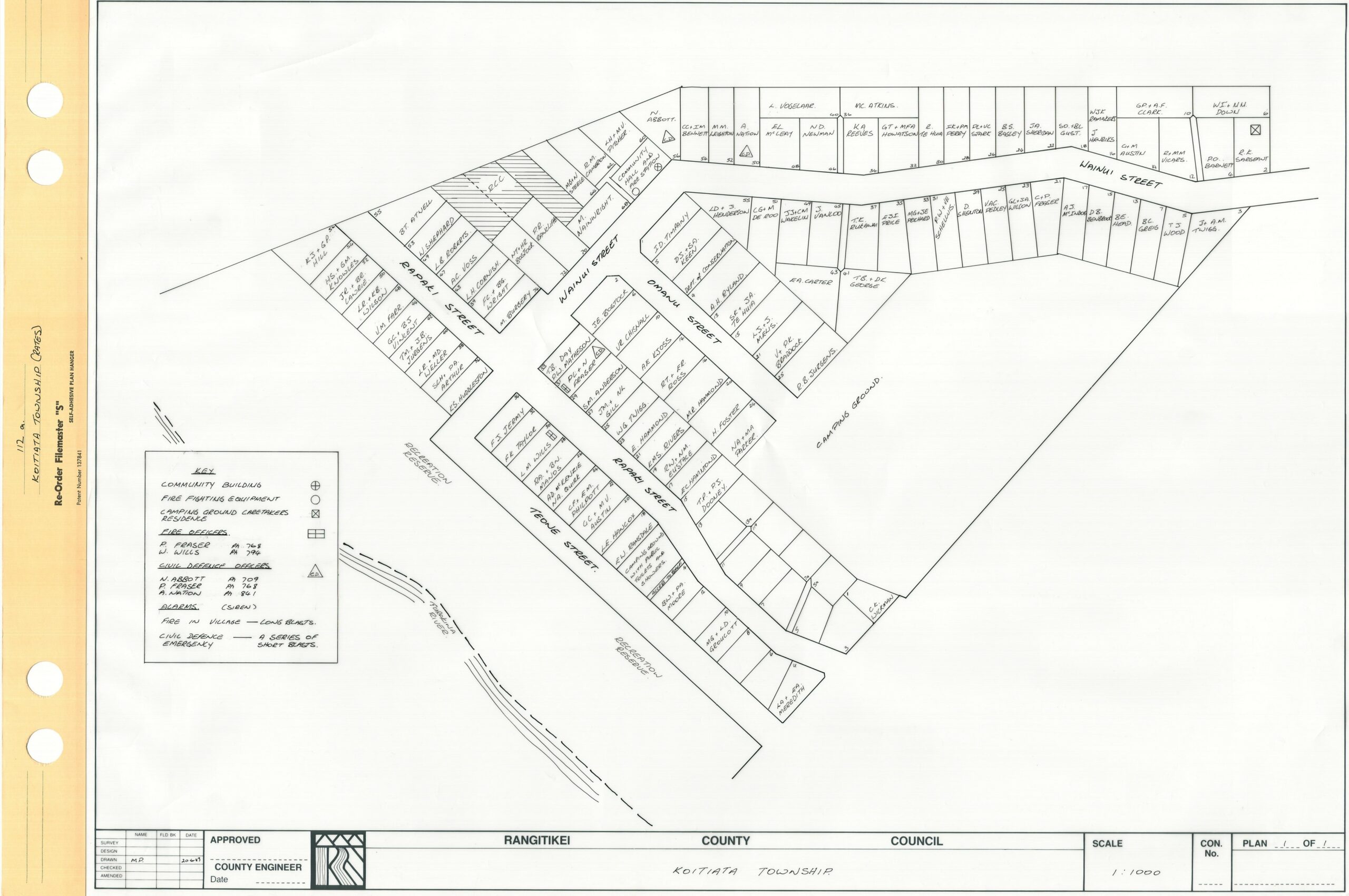
Koitiata Township Survey
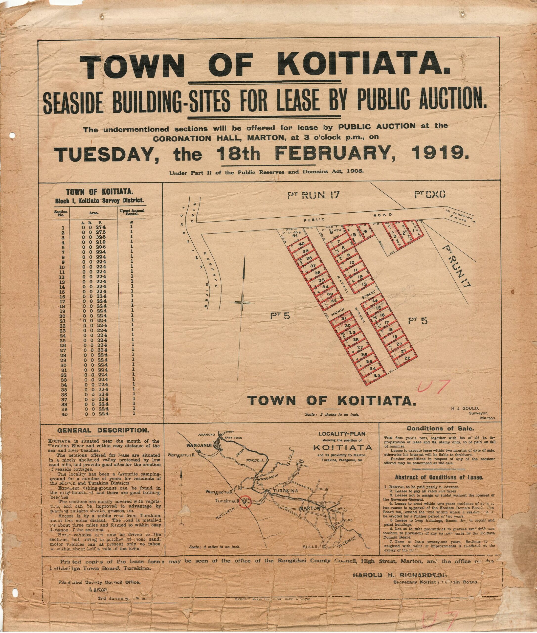
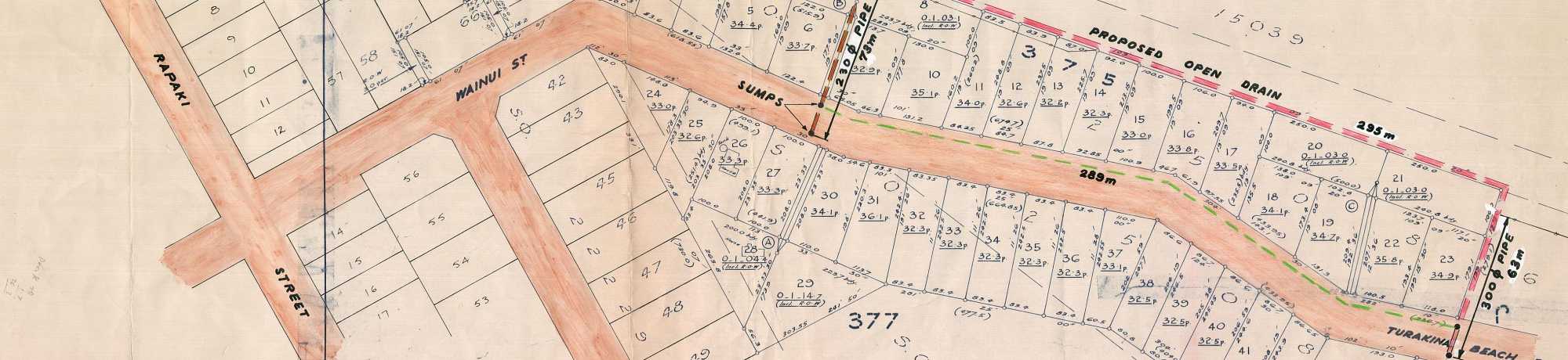
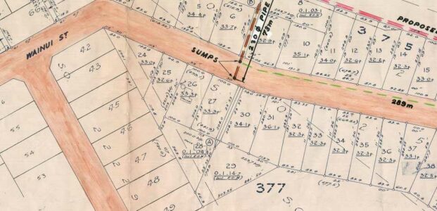
Koitiata Seaside Sites
Where is the Village
Omanu Street Survey
Koitiata is Currently Full
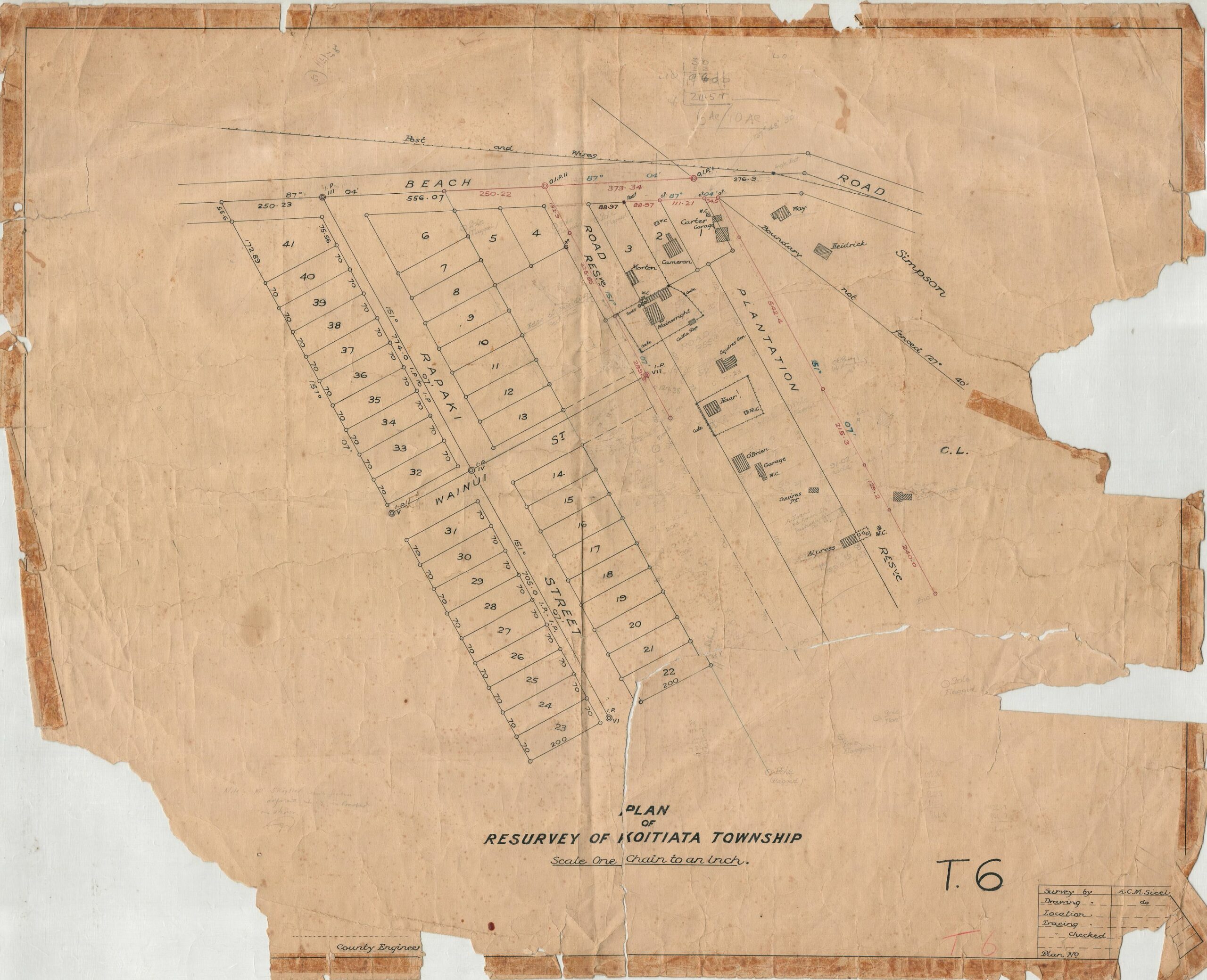
Wainui Street is Coming